Tuesday, July 25, 2006
The Story of Newfoundland
 Here is one excerpt from The Story of Newfoundland. A great historical read and free online at Gutenberg.org
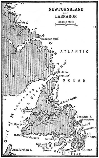
To understand that story a short account must be given at the outset of the situation and character of the island. But for the north-eastern side of the country, which is indented by deep and wide inlets, its shape might be roughly described as that of an equilateral triangle. Its area is nearly 43,000 square miles, so that it is larger than Scotland and considerably greater than Ireland, the area of which is 31,760 square miles. Compared to some of the smaller states of Europe, it is found to be [9]twice as large as Denmark, and three times as large as Holland. There is only a mile difference between its greatest length, which from Cape Ray, the south-west point, to Cape Norman, the northern point, is 317 miles, and its greatest breadth, from west to east, 316 miles from Cape Spear to Cape Anguille. Its dependency, Labrador, an undefined strip of maritime territory, extends from Cape Chidley, where the Hudson's Straits begin in the north, to Blanc Sablon in the south, and includes the most easterly point of the mainland. The boundaries between Quebec and Labrador have been a matter of keen dispute. The inhabitants are for the most part Eskimos, engaged in fishing and hunting. There are no towns, but there are a few Moravian mission stations.
![]()
Subscribe to Posts [Atom]
