Wednesday, August 31, 2005
5 Wing Goose bay, has no weather?
It’s no surprise 5 Wing Goose Bay is having trouble keeping foreign nations there for training. They don’t even have a Doppler radar for accurate forecasting? Not even one for the whole entire region of Labrador?
Not to mention there isn’t a Canadian fighter squadron posted in Goose Bay. Why should foreigners stay when our own government won’t station a squadron there? Where’s the camaraderie? Canada has missed a great opportunity to foster international relations in NL 5 Wing Goose Bay.
Click on image to enlarge.
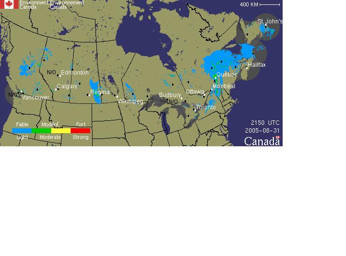
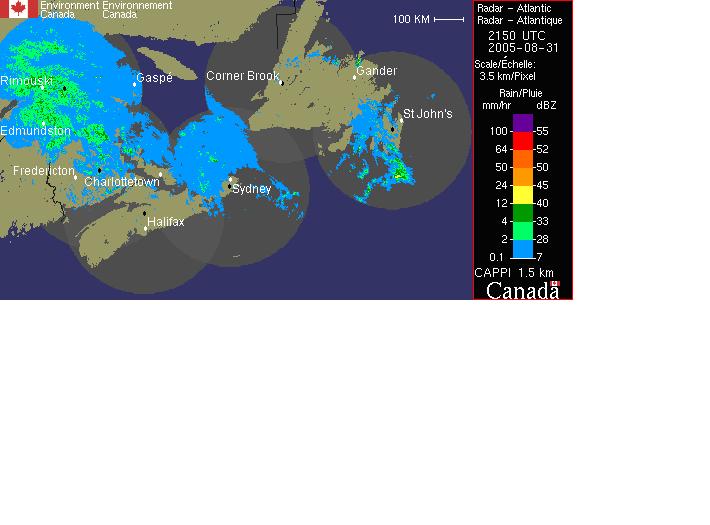
RADAR station is represented by a black dot.

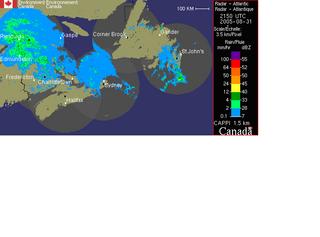
Also of note when looking at the Canadian map (taken from enviroment canada's web site) is that it isn't pointing north. This explains why NL looks like it's above the Yukon when in reality over half the island portion is below the 49'th parallel?
I fail to see why this is like this?
Is there a shortage of paper?
Has the north pole moved?
Did magnetic north move?
Is there a policy to try and hide NL on the maps?
Are maps represented by population as well?
Are enviorment Canada's compasses broken or in need or calibration?
Is Ontario the center of the universe?
Every map I've ever used always had North at the top! Why doesn't enviroment canada's map have north at the top?
Not to mention there isn’t a Canadian fighter squadron posted in Goose Bay. Why should foreigners stay when our own government won’t station a squadron there? Where’s the camaraderie? Canada has missed a great opportunity to foster international relations in NL 5 Wing Goose Bay.
Click on image to enlarge.
RADAR station is represented by a black dot.
Also of note when looking at the Canadian map (taken from enviroment canada's web site) is that it isn't pointing north. This explains why NL looks like it's above the Yukon when in reality over half the island portion is below the 49'th parallel?
I fail to see why this is like this?
Is there a shortage of paper?
Has the north pole moved?
Did magnetic north move?
Is there a policy to try and hide NL on the maps?
Are maps represented by population as well?
Are enviorment Canada's compasses broken or in need or calibration?
Is Ontario the center of the universe?
Every map I've ever used always had North at the top! Why doesn't enviroment canada's map have north at the top?
Comments:
<< Home
I think the problem with environment canada is that they don't know up from down.
As for 5 Wing, you couldn't have said it better. Canada has lost a big opportunity to foster international camraderie.
Post a Comment
As for 5 Wing, you couldn't have said it better. Canada has lost a big opportunity to foster international camraderie.

Subscribe to Post Comments [Atom]
<< Home
![]()
Subscribe to Posts [Atom]
